
Spatial Data Mapping For European Hospitals, Clinics And Healthcare Facilities
Make healthcare facilities easy to find, easy to navigate, and easy to manage.
Hospitals, clinics and medical centres across Europe are complex environments. Multiple departments, corridors, waiting areas, treatment rooms and emergency routes need to stay clear for patients, medical staff, visitors and compliance officers, often coordinated across campuses and time zones.
360 View EU creates a connected spatial data layer for healthcare operators across the continent using Google Street View, Matterport digital twins, point cloud scanning and immersive wayfinding. From our Barcelona production hub, we deliver the right layer for each intent, with consistent quality built to stay useful for years across your European facility portfolio.
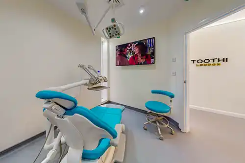
Clarity Before Arrival. Confidence Inside.
Help Patients Find The Right Department Before They Arrive
Let patients and visitors preview hospital entrances, parking, reception areas and department locations before their appointment. Immersive previews reduce anxiety for patients navigating unfamiliar healthcare environments across European cities, turning complex hospital layouts into clear, confident journeys.
Support Remote Facility Assessment For Healthcare Networks Across Europe
Healthcare administrators managing multiple facilities need to assess renovation needs, capacity constraints and equipment positioning without visiting every site. Spatial documentation lets regional managers evaluate layouts remotely, cutting unnecessary travel across European healthcare networks.
Streamline Compliance Documentation Across Cross-Border Facilities
Healthcare groups operating across European countries need consistent documentation for regulatory compliance, infection control audits and accreditation renewals. A shared spatial layer gives compliance officers and facilities managers the same accurate reference, whether the facility is in Barcelona or Brussels.
Improve Patient Safety And Emergency Preparedness Across Facilities
Pre-arrival familiarisation with emergency exits, evacuation routes and assembly points supports safety planning for both staff and patients. Digital twins give safety teams a permanent, auditable reference for fire compliance, emergency drills and accessibility assessments across your European healthcare portfolio.
One Facility. Multiple Spatial Layers.
Different Outcomes Need Different Capture Methods. We Design The Right Mix, Then Connect It Into One Consistent Facility View Across Your European Portfolio.
A hospital is not one use case. Patient wayfinding needs clear navigation from car park to department. Compliance teams need accurate floor plans. Facilities managers need measured layouts for equipment planning. Emergency planning needs connected routes across wings and floors. We build the right spatial layers so the facility remains consistent across systems and stays useful for years, whether you operate one clinic or twenty across Europe.
Google Street View For Facility Visibility And Patient Confidence
Full Exterior And Campus Coverage
Google Street View captures the complete facility exterior, entrance approaches, car parks, ambulance bays and campus pathways. Patients arriving for appointments across European cities can preview the exact route to the right entrance, reducing stress and missed appointments.
Reception And Public Area Navigation
Interior Street View coverage of main lobbies, reception desks, waiting areas and corridor junctions gives patients a realistic preview before arrival. Visitors and referring clinicians can orient themselves remotely when navigating complex European hospital campuses.
Permanent Google Maps Presence With Zero Monthly Fees
Published Street View tours appear directly on Google Maps and Google Search, giving your facility immersive visibility where patients are already searching. This is permanent coverage with no hosting costs, building trust for hospitals and clinics across European healthcare systems.
Matterport Digital Twins For Clinical Space Documentation
Immersive Department And Ward Tours
Matterport captures departments, wards and treatment areas in full 3D, letting administrators and compliance teams review layouts without site visits. For multi-site healthcare groups, this replaces paper floor plans with navigable models that stay accurate and accessible across European facilities.
Equipment And Space Planning
Treatment rooms, operating theatres and diagnostic suites are captured with accurate measurements. Facilities teams can plan equipment installations, room reconfigurations and capacity changes remotely, reducing costly on-site surveys for healthcare networks across the continent.
Accreditation And Audit Documentation
Digital twins provide an accurate as-built record for accreditation bodies, health inspectors and insurance assessors. Spatial relationships, room dimensions and facility conditions are captured once and referenced across every compliance cycle, reducing documentation burden for European healthcare operators.
Point Cloud Scanning For Technical Healthcare Planning
Millimetre-Accurate Building Measurements
Point cloud scanning captures the precise geometry of operating theatres, imaging suites, laboratories and plant rooms. This data feeds directly into BIM software and CAD platforms, giving architects and engineers the accuracy they need for healthcare facility renovations across Europe.
Medical Equipment Installation Planning
MRI machines, CT scanners and linear accelerators require precise spatial data for installation planning. Point cloud scanning provides the exact room dimensions, floor loading data and access route measurements that equipment manufacturers and installers need to deliver on time.
MEP And Infrastructure Upgrades
Mechanical, electrical and plumbing systems in healthcare facilities require precise documentation for upgrades. Point cloud scanning creates the spatial reference needed for HVAC improvements, medical gas installations and electrical upgrades across multi-storey hospital buildings.
Immersive Wayfinding Across Large Hospital Campuses
Connected Patient Navigation From Gate To Department
Large hospital campuses with multiple buildings, departments, car parks and entrances need intuitive navigation. Immersive wayfinding connects every patient touchpoint into a single navigable experience, reducing missed appointments and improving satisfaction across European healthcare facilities.
Emergency And Evacuation Route Planning
Clinical staff, emergency responders and facilities teams need clear, documented routes through complex hospital layouts. Embedded wayfinding provides pre-arrival familiarisation with emergency exits, assembly points and evacuation procedures for staff training across European healthcare sites.
Pre-Arrival Orientation For International Patients
Patients travelling to European healthcare facilities for specialist treatment can preview the entire campus layout before travelling. Wayfinding tools embedded on your website let patients familiarise themselves with department locations, parking, entrances and accessibility routes, reducing anxiety for first-time visitors.
What A Typical Healthcare Project Looks Like
Full Facility Coverage From Main Entrance To Every Department
Google Street View captures the complete exterior, entrance approaches, car parks, ambulance bays and campus pathways. For multi-building hospital campuses, this means full coverage from the main road to every department entrance. Patients arriving by car, public transport or ambulance can preview the exact route. Coverage is coordinated from our Barcelona production hub across your European healthcare portfolio.
Internal Visibility For Individual Departments And Clinical Areas
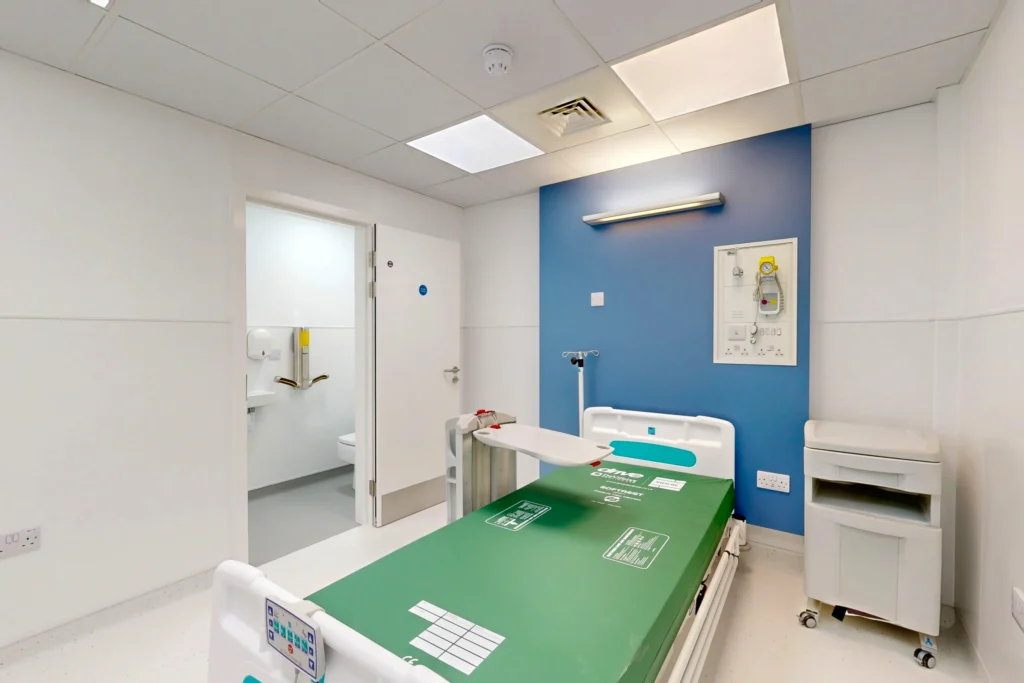
Matterport digital twins capture reception areas, waiting rooms, treatment departments, wards and rehabilitation spaces in full 3D. Each area becomes a navigable digital twin that administrators, compliance officers and facilities teams can reference remotely. Departments are captured once and reused across wayfinding, compliance and operations.
Google Maps Listings Corrected And Optimised
Map pin positions are verified and corrected for every entrance, department, A&E bay and outpatient clinic. Local language listings are confirmed for facilities serving international patients across European markets, ensuring that Google Maps directions bring patients to the correct entrance.
Embedded Into Websites, Patient Portals And Healthcare Management Systems
Street View tours and Matterport models are delivered in formats ready for your website, patient portal, referral platforms and internal systems. All outputs follow European accessibility standards and connect seamlessly with healthcare management workflows across your facility network.
Frequently Asked Questions
Quick answers for European hospital administrators, facilities managers, compliance officers, and healthcare planners.
Can you digitise an entire European hospital campus with multiple buildings and departments?
Yes. Entire hospital campuses and multi-building healthcare facilities across Europe can be captured as one connected project. We combine Google Street View for exteriors and campus routes, Matterport for departments and clinical areas, and point cloud scanning for technical documentation. Coverage is planned and coordinated from our Barcelona production hub to minimise disruption to clinical operations.
Can Google Street View cover the full exterior and grounds of a large hospital campus?
Yes. Hospital campuses with extensive grounds, multiple car parks, ambulance bays, pedestrian pathways and interconnected buildings can be mapped with full 360-degree coverage. Street View tours capture every patient-facing route, ensuring visitors can preview the journey from any entrance to their appointment.
How large can a clinical area be for Matterport digital twin capture?
Operating theatres, imaging suites, wards and outpatient departments ranging from small consultation rooms to large open-plan treatment areas of several thousand square metres can be captured as Matterport digital twins. Each space includes accurate measurements, supporting equipment planning and compliance documentation across European healthcare facilities.
How does spatial data improve patient wayfinding across a European hospital campus?
Patients can preview the full campus layout before arriving, including routes from car parks to their department, reception locations, waiting areas and emergency exits. For large hospital campuses across Europe, this reduces missed appointments, improves patient satisfaction and supports accessibility compliance for visitors with mobility requirements.
Can Google Street View fix incorrect map pins and create listings for hospital departments?
Yes. Google Maps pins can be corrected, new listings created for individual departments, outpatient clinics and specialist centres within the hospital, and local language details verified for international patients. This ensures every patient arriving via Google Maps reaches the correct entrance for their appointment.
Can Street View tours and Matterport models be embedded on our hospital website and patient portals?
Yes. Embedded Street View tours and Matterport models can be placed directly into your hospital website, patient portals, referral platforms and internal systems. All embed formats follow European web accessibility standards and are optimised for patients browsing from any device.
Can Matterport capture multiple floors, basements and restricted areas inside hospitals?
Yes. Matterport can capture multi-storey hospitals including ground-floor reception areas, upper-floor wards, basement laboratories, imaging suites and rooftop plant rooms. Each level connects into one navigable model, giving a complete vertical view of the facility for operations, compliance and emergency planning.
How do digital twins support healthcare compliance and accreditation across European facilities?
Digital twins provide a permanent, accurate record of facility layouts, department configurations, emergency routes and equipment locations. For European healthcare groups, this supports accreditation documentation, infection control audits, CQC-equivalent inspections and insurance assessments that can be referenced at any time without on-site visits.
Can Google Street View, Matterport and point cloud scanning be delivered as one project?
Yes. Many healthcare projects combine all three capture methods into one coordinated visit. Street View covers exteriors and campus routes, Matterport captures departments and clinical areas in 3D, and point cloud scanning delivers precise measurements for renovation and equipment planning. Everything is coordinated as one project from our Barcelona production hub.
Do you cover multiple healthcare facilities across different European countries?
Yes. We cover healthcare facilities across European countries from a single coordination point in Barcelona. Whether your network includes urban hospitals, suburban clinics, or specialist treatment centres, we plan multi-site capture schedules that minimise travel costs and deliver consistent quality across every location.
Didn’t see your question here? We’ll answer it personally, just get in touch.
We Handle The Complexity. You Get The Visibility.
1. Tell Us About Your Healthcare Environment
You share your facility details, department layouts and priorities. We review your campus and design the right combination of spatial layers, whether that means Street View for exterior approaches and parking, Matterport for clinical departments and wards, point cloud scanning for renovation planning, or all three connected together. We coordinate scheduling across your European facilities from our Barcelona production hub.
2. One Visit, Complete Spatial Documentation
Our capture teams work around your live clinical operations to minimise disruption across each facility. We then process the data, blur faces and sensitive information for privacy compliance, and build the connected spatial layers that link entrances, corridors, departments and wards into one consistent facility view.
3. Patients And Partners Can Explore Remotely
Spatial layers are published, embedded and delivered in the formats your teams need. Street View goes live on Google Maps permanently with zero monthly fees. Digital twins, point cloud data and wayfinding tools are delivered ready to use across wayfinding, compliance, staff training and planning, for years.
Tell Us About Your European Facility