
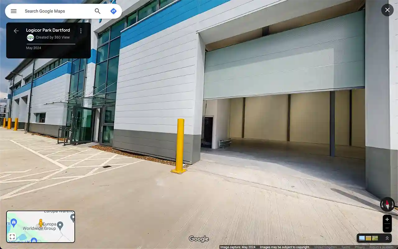
Logicor Park Dartford Google Street View Tour by 360 View. Logicor manages an 82,203 sq ft industrial estate in Kent with 20 grade-A units across multiple buildings. To make the park inspectable online for prospective tenants, brokers and operators across Europe, Logicor partnered with 360 View to capture the entire estate as an Outdoor Google Street View tour, navigable on Google Maps.
How Prospective Tenants Use the Logicor Park Dartford Google Street View Tour
A logistics manager evaluating warehouse space at Logicor Park Dartford can walk the entire estate from their desk. They see the approach from the surrounding road network, the gatehouse, internal roads, building elevations, loading bays, and parking layout. They confirm clearance heights, turning circles for HGVs, and yard depth before scheduling a site visit. Decisions move from speculation to verification.
Why Logicor Built This Logistics Park Virtual Tour
Logicor manages industrial estates across Europe. Tenant decisions on multi-million-pound leases happen in stages: shortlist, virtual inspection, site visit, contract. The Logicor Park Dartford Google Street View tour shortens the shortlist-to-visit gap by giving brokers and decision makers the spatial confidence they need before booking travel.
What the Outdoor Google Street View Tour Captures at Logicor Park Dartford
Every internal road, every unit elevation, every yard area is captured in 360 degrees and stitched into a continuous walkable tour. The Logicor Park Dartford Google Street View tour begins at the estate entrance and lets visitors navigate through every road, past every building, around every loading area. Faces and vehicle registration plates are blurred for GDPR compliance before publication.
How Industrial Property Brokers Use a Logistics Park Virtual Tour
Industrial property agents pitch Logicor Park Dartford to clients across the UK and Europe without leaving the office. They share a Google Maps link in an email, walk the prospect through key units on a video call, highlight available stock, and answer site-specific questions in real time. The Outdoor Google Street View tour becomes the broker’s most consistent sales tool.
How Logistics Park Operators Plan and Maintain Sites
Estate managers, security teams, and contractors use the Logicor Park Dartford Google Street View tour to plan routes, brief contractors, document conditions, and orient new staff. The same spatial data that sells units to prospects also reduces operational friction for the people running the site every day.
The Outcome for Logicor
Logicor Park Dartford is now visible on Google Maps as a fully navigable estate. Prospective tenants self-qualify before viewing. Brokers move faster. The estate stands out among logistics parks competing for the same audience. The capture was a one-off investment; the visibility is permanent. Browse our other logistics and industrial case studies for similar projects.
Built for Logistics Parks, Industrial Estates, and Multi-Building Sites
Outdoor Google Street View suits any large estate where the approach, internal roads, and building positions matter. Logistics parks, business parks, university campuses, hospital grounds, and gated industrial sites all benefit from the same navigable spatial layer. Capture takes one to two days for most estates. The tour goes live on Google Maps within five to seven working days. See our wider Logistics & Industrial services for end-to-end coverage.
Frequently Asked Questions
How long does it take to capture a logistics park like Logicor Park Dartford?
Most logistics parks of 50-100 units are captured in one to two days. Logicor Park Dartford was captured across the entire 82,203 sq ft estate in a single capture session. The Outdoor Google Street View tour goes live on Google Maps within five to seven working days after capture.
Does the Logicor Park Dartford Google Street View Tour cover individual unit interiors?
This tour covers exterior roads, building elevations, yard areas, and loading bays. Interior unit captures are available through Indoor Google Street View as a complementary service for tenants who want their specific unit interior on Google Maps.
How much does a logistics park virtual tour cost?
Most logistics park projects sit between £3,000 and £10,000 depending on estate size, number of buildings, and whether interior coverage is included. Request a free quote for an exact figure based on your estate.
Can brokers and tenants share the Logicor Park Dartford Google Street View Tour?
Yes. The tour is a Google Maps URL anyone can share. Brokers send it in pitch emails, tenants share it with their teams, and operators embed it on their estate landing page. No app, no login, no subscription.
Does this work for multi-site estate operators with parks across Europe?
Yes. Operators with multiple parks can capture every estate as a separate Google Street View tour. Each park has its own navigable layer on Google Maps, and operators can link them from a central portfolio page or sales presentation.
How does a Google Street View tour help logistics park visibility on Google and AI search?
A captured estate generates more engagement on its Google Business Profile, longer time-on-listing, and richer spatial data for AI search systems like Gemini and ChatGPT to understand and recommend the location. AI assistants increasingly recommend places they can verify spatially.