
Spatial Data Mapping for European Logistics Parks and Industrial Estates
Make large European estates easy to find, easy to navigate, and easy to manage.
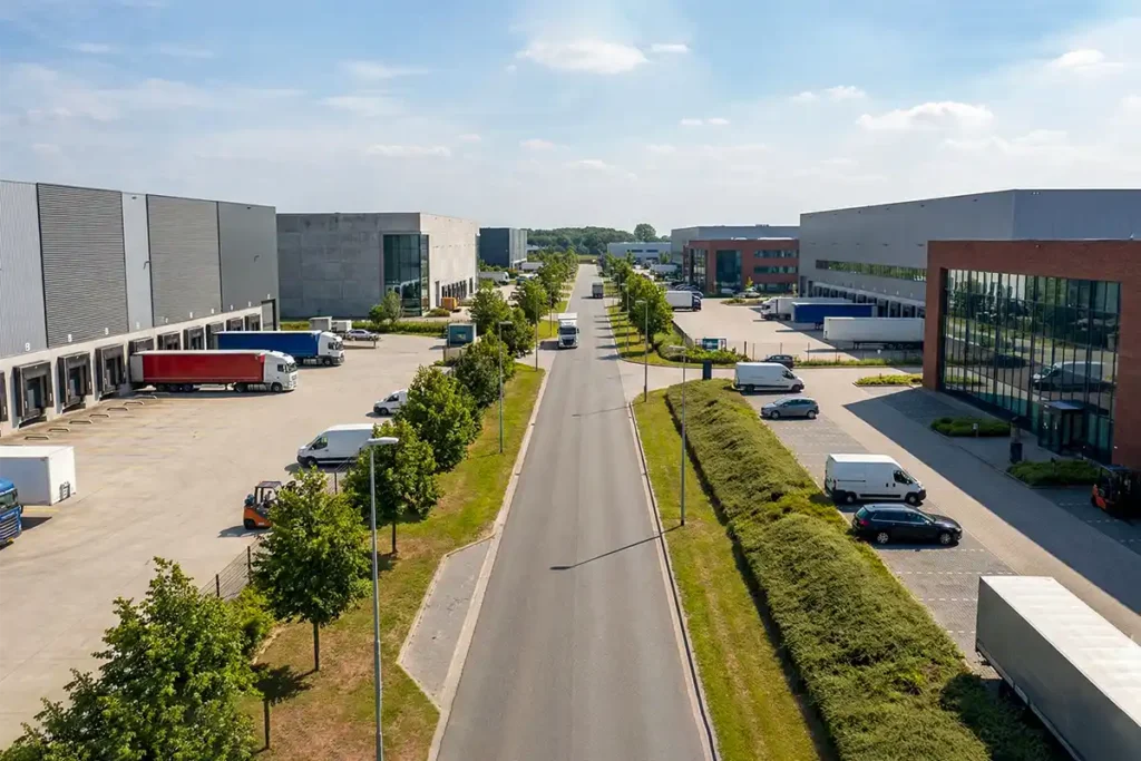
Logistics parks and industrial estates across Europe are complex environments. Multiple buildings, access roads, yards, gates and warehouse units need to stay clear for tenants, contractors, drivers and internal teams , often coordinated across borders and time zones.
360 View EU creates a connected spatial data layer for logistics and industrial operators across the continent using Google Street View, Matterport digital twins, point cloud scanning and immersive wayfinding. From our Barcelona production hub, we deliver the right layer for each intent , with consistent quality built to stay useful for years across your European portfolio.
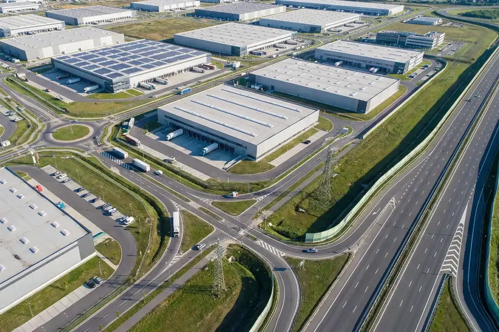
Clarity Before Arrival. Confidence On Site.
Help People Reach the Right Gate and Entrance
Reduce wrong arrivals across multi-unit European estates. Drivers, visitors and contractors , including those arriving from another country , can confirm the route, gate and correct entrance before setting off.
Support Leasing With Better Pre-Qualification Across European Markets
Make viewings more focused and decision-ready. Prospects across Europe can understand context and layout earlier, so in-person viewings happen with the right expectations and fewer wasted international trips.
Improve Operational Coordination Across Cross-Border Teams
A shared, visual reference for estates that change over time. Site teams, facilities, H&S and contractors across multiple European locations work from the same up-to-date spatial layer when planning works and access.
Improve Safety and Preparedness Across European Sites
Support planning without disrupting live operations. Teams can familiarise themselves with routes, constraints and key areas before work begins , particularly valuable when coordinating safety briefings across facilities in different European countries.
One Estate. Multiple Spatial Layers.
Different outcomes need different capture methods. We design the right mix, then connect it into one consistent estate view across your European portfolio.
A logistics estate isn’t one use case. Leasing needs clarity and context. Operations need reliable access information. Technical teams may need measurable data. We build the right spatial layers so the estate remains consistent across systems and stays useful for years , whether you operate one park or twenty across Europe.
Google Street View for Estate Visibility and Accessibility
Capture Every Road, Gate and Entrance
We photograph and publish extensive outdoor and indoor Street View coverage across the entire estate so every access road, gate, building entrance and unit is visible on Google Maps. From distribution hubs along the Rhine corridor to industrial zones near Mediterranean ports, every route is documented.
Help Drivers and Visitors Navigate Your Park
HGV drivers crossing borders, visiting contractors and local delivery teams can see exactly how to reach the correct location before setting off. This reduces missed deliveries, wrong turns and time wasted navigating unfamiliar European estate layouts.
Increase Visibility and Trust for Leasing
Accurate map pins, verified business listings and immersive imagery make available units easier to find and easier to trust online. Leasing teams marketing to cross-border tenants use this to attract interest faster and qualify prospects before in-person viewings.
Matterport Digital Twins for Internal Visibility
Explore Internal Layouts Remotely
Teams walk through warehouses and industrial units from anywhere in Europe, inspecting floor areas, ceiling heights and spatial conditions without travelling to site. This is particularly valuable for operators managing portfolios across multiple countries.
Take Measurements Inside the Model
Built-in measurement tools allow leasing agents, surveyors and engineers to take accurate dimensions directly within the digital twin. Measurements display in metric units, consistent with European construction and leasing standards.
Support Marketing, Briefings and Planning
These interactive 3D models are used for tenant marketing across language barriers, facilities condition assessments, contractor familiarisation and health and safety preparation before works begin on European sites.
Point Cloud Scanning for Precise Measurement and Planning
Laser-Accurate Spatial Data
We carry out laser scanning and deliver point cloud data with derived CAD or BIM outputs for precise measurement, layout design and spatial documentation. Deliverables meet European survey standards and integrate with continental design workflows.
Plan Refurbishments and Equipment Layouts
This data supports refurbishment planning, equipment positioning, asset condition surveys and technical audits across complex industrial environments. From cold-storage retrofits in the Netherlands to warehouse conversions in Catalonia, accurate geometry prevents costly errors.
Trusted by Surveyors and Engineering Teams
Surveyors, engineers and project teams across Europe rely on point cloud data when accurate geometry and reliable spatial measurements are essential to the project. Outputs are delivered in formats compatible with European BIM and FM platforms.
Immersive Wayfinding Across Large Multi-Building Estates
Connected Routes From Road to Unit
We connect Street View routes, internal digital twins and mapping data so users can navigate from the main road, through the estate and into the correct unit without confusion. This is especially valuable on European estates where signage may be in multiple languages.
Solve Complex Multi-Building Navigation
This is particularly valuable for large parks with multiple buildings, shared access roads and complex entry points where first-time visitors and international drivers often get lost. Clear visual wayfinding removes language barriers from site navigation.
Preview the Journey Before Arriving
Visitors, contractors, delivery drivers and staff use this connected spatial layer to understand routes, entrances and access points before arriving on site. For cross-border logistics operations, this preparation reduces delays and improves first-visit efficiency.
What To Expect From A European Logistics Project
Complete Site Documentation From Perimeter To Individual Units
A typical project begins with estate-wide Google Street View coverage. We capture every access road, gate, building entrance and unit so drivers, visitors and contractors can navigate the entire site before arriving. Our Barcelona production hub coordinates capture teams across European locations.
Interior Mapping For Each Warehouse And Facility Space
Matterport digital twins are created for individual units so internal layouts, floor areas and spatial conditions are visible remotely. These models are used for tenant marketing across borders, facilities planning and contractor briefings in any language.
Google Listings Verified And Positioned For Local Discovery
Map pins, business listings and building names are corrected so every unit on the estate is accurately represented on Google Maps and discoverable by search engines and AI. Listings are verified in the correct local language and format for each European market.
Integrated Into Your Digital Platforms And Management Tools
Immersive views are embedded directly into leasing portals, client websites and operational platforms. Point cloud scan data is delivered where precise measurement and spatial planning is required. All deliverables use metric standards and European-compatible formats.
Frequently Asked Questions
Quick answers for European estate managers, leasing teams, operations, and technical stakeholders.
Can you digitise an entire European logistics park with multiple buildings and access roads?
Yes. Entire logistics parks and industrial estates across Europe can be captured as one connected digital environment, including internal access roads, estate perimeters, multiple buildings and individual warehouse units. The result is a complete spatial dataset that supports navigation, leasing and operational planning across the full site. We coordinate multi-day captures for large European estates from our Barcelona production hub.
Can Google Street View cover kilometres of internal estate roads?
Yes. Internal road networks spanning several kilometres can be mapped with full Street View coverage so that drivers, visitors and contractors can navigate from the estate entrance directly to the correct building or unit entrance. This is particularly valuable on large European distribution parks where international drivers may be unfamiliar with local estate layouts.
How large can a warehouse be for Matterport digital twin capture?
Warehouses and distribution centres ranging from a few hundred square metres to very large facilities spanning thousands of square metres can be captured. Multi-unit estates with dozens of individual buildings can also be covered as a single connected project. We have captured large-format European distribution centres and cold-storage facilities across multiple countries.
How does spatial data improve wayfinding across a European logistics estate?
Users can preview the full route through the estate before arriving, recognising landmarks, gates, building numbers and turning points. This reduces confusion for HGV drivers navigating cross-border deliveries, improves first-time visitor navigation and helps contractors locate the correct access point without assistance. On multilingual European estates, visual wayfinding removes the language barrier from site navigation entirely.
Can Google Street View fix incorrect map pins and create listings for individual units?
Yes. Google Maps pins can be corrected, new business listings created and each building or warehouse unit given its own verified map presence. This ensures tenants, visitors and search engines can find and identify every individual unit on the estate. For European estates, listings are verified in the correct local language and format for each market.
Can Street View tours and Matterport models be embedded on our website and leasing portals?
Yes. Embeddable links and iframes allow Street View navigation and Matterport digital twins to be displayed directly on websites, leasing portals and operational platforms. This gives prospective tenants and stakeholders across Europe instant spatial access without leaving your site. Embeds work across all devices and require no downloads.
Can Matterport capture mezzanines, upper floors and restricted areas inside warehouses?
Yes. Multi-level areas including mezzanines, upper floors and restricted-access zones can be captured to create a complete digital representation of the entire internal environment. Access permissions and scheduling are coordinated with your facilities team to ensure capture works around active European warehouse operations.
How do digital twins support health and safety compliance on European sites?
Yes. Digital twins provide a visual walkthrough of fire exits, hazard zones, muster points and access routes so staff and contractors can familiarise themselves with the environment before arriving on site. This supports compliance with European health and safety directives, induction efficiency and safety preparedness across sites in different jurisdictions.
Can Google Street View, Matterport and point cloud scanning be delivered as one project?
Yes. Google Street View, Matterport digital twins and point cloud scanning are frequently combined into a single coordinated project. This creates one connected spatial layer that supports wayfinding, leasing visibility, technical planning and operational understanding across the entire estate. For European operators, a single coordinated project ensures consistent quality across all deliverables.
Do you cover multiple logistics parks across different European countries?
Yes. Multiple logistics parks and industrial estates across different European countries can be captured and delivered as a consistent spatial system, so operators can manage, present and compare their estates in the same structured way across all locations. We coordinate multi-site European projects from our Barcelona hub, ensuring standardised capture protocols and unified deliverables regardless of country.
✅ Didn’t see your question here? We’ll answer it personally, just get in touch.
We Handle The Complexity. You Get The Visibility.
1. Tell Us About Your European Sites
You share your estate details, site locations and priorities. We review your layout and design the right combination of spatial layers, whether that means Street View for access roads, Matterport for individual units, point cloud scanning for technical planning, or all three connected together. We coordinate scheduling across your European locations from our Barcelona production hub.
2. One Visit Per Site, Full Spatial Capture
Our capture teams work around your live operations to minimise disruption across each site. We then process the data, blur faces and sensitive information for privacy compliance, and build the connected spatial layers that link roads, buildings and units into one consistent estate view.
3. Your Estate Documentation Goes Live
Spatial layers are published, embedded and delivered in the formats your teams need. Street View goes live on Google Maps permanently with zero monthly fees. Digital twins, point cloud data and wayfinding tools are delivered ready to use across leasing, operations, safety and planning, for years.
Tell Us About Your European Estate